Review of HYDRAfloods
The HYDrologic Remote Sensing Analysis for Floods platform or HYDRAFloods is a publicly available, web-based, near real-time tool for enhanced flood monitoring. (https://hydrafloods-servir.adpc.net/) HYDRAFloods helps with emergency response and relief sectors by providing flood extent information. This flood monitoring system uses open-source satellite remote sensing data from optical and Synthetic Aperture Radar (SAR) sensors. In addition, it was developed in Google Earth Engine and Google Cloud Platform with Python API.
Let’s explore the different menus, such as materials, methodology & documentation, and use cases.
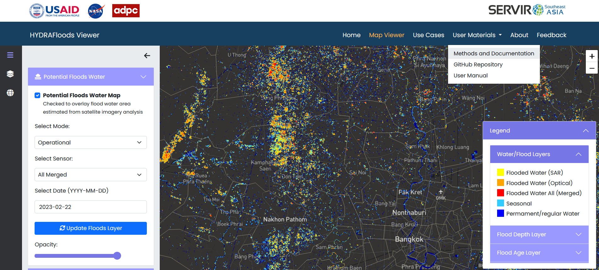
Figure 29. HYDARFloods viewer
Feedback: survey