Overview
You’ve successfully written a remote sensing workflow to train a Random Forest classification model to map Land Cover with the Landsat archive. Now make it your own! There are several ways to tweak the original workflow right away to change the objective and make improvments. Here are a few ideas. Collaborate with your colleagues and your instructors. Happy Coding!
Area of Interest (AOI)
We defined our AOI at the beginning of the script using FAO GAUL data. As discussed previously you can define an AOI in GEE in many other ways - like using the Drawing tools or loading in your own layer that you’ve uploaded to Earth Engine.
Date Range
After merging together our full Landsat ImageCollection, we filtered it on a date range. Come up with another date range that you’d like to map land cover for. Remember that we can also specify a Day of Year range in our filters on the ImageCollection. This is useful for areas where there is heavy cloud cover during a certain time of year, or the phenomena you want to map exhibits a specific seasonal pattern that we can sense from satellite data.
Model Structure
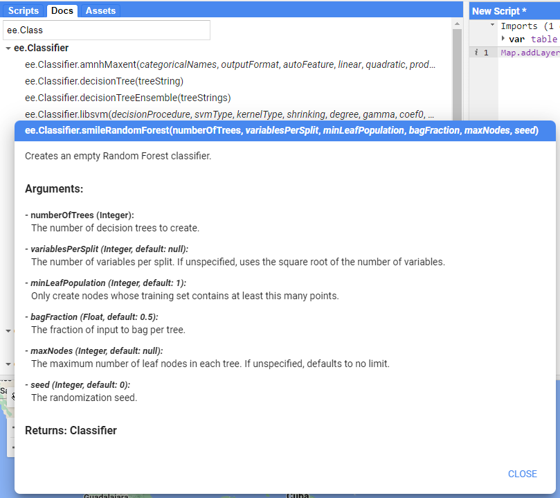
There are several ways we could make our RF model more robust…
The first is in the number of ‘trees’ in the Random Forest. You can change that in the ee.Classifier.smileRandomForest() function and observe whether any of the accuracy metrics have improved.
Reference Data & Input Data
Beyond the model structure itself, we can also provide more and/or better reference data to the model. The first improvement would be to increase the amount of total samples. Try a number between 200 and 500 per class.
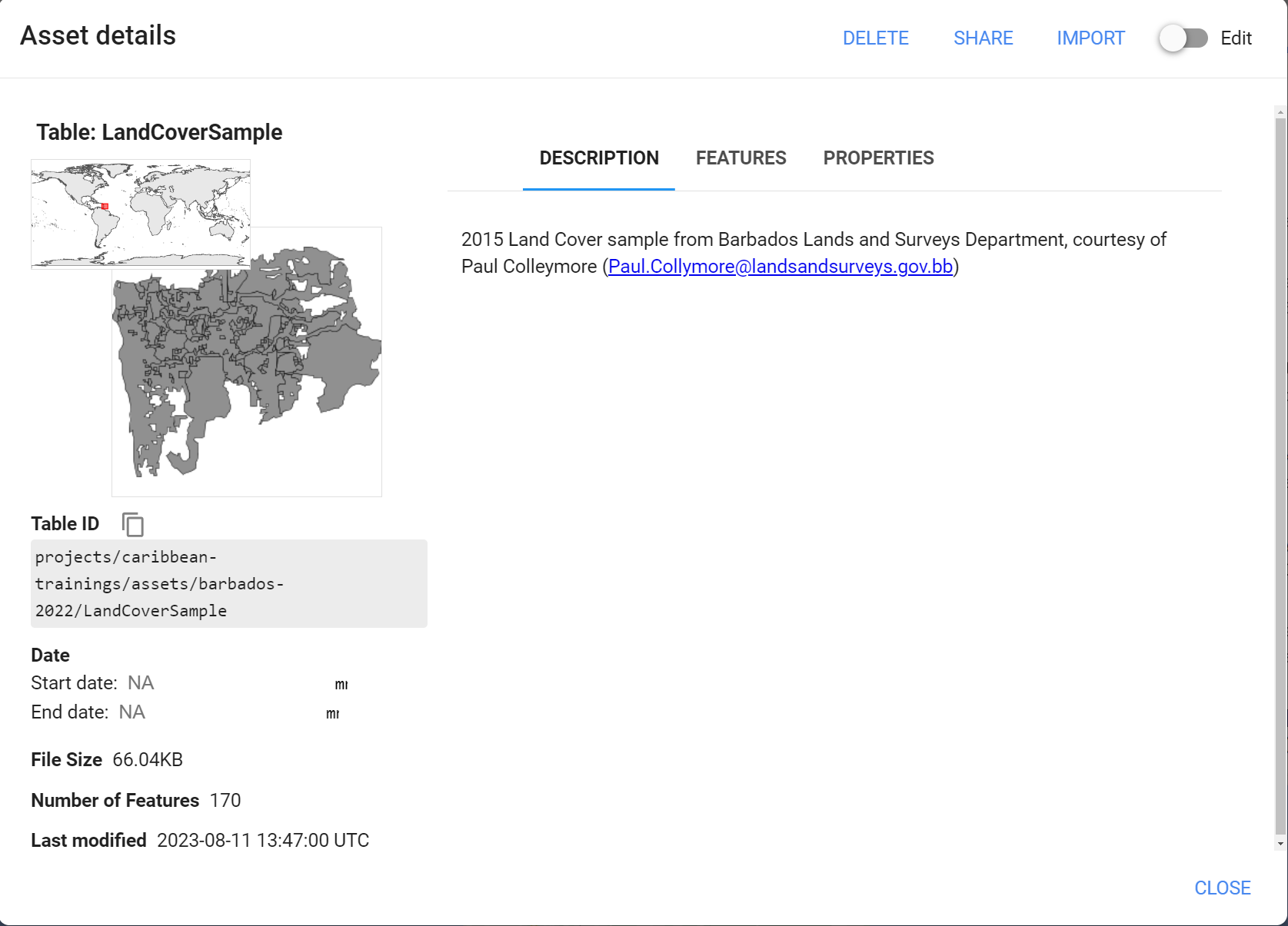
To provide better quality reference data, we can look for another source of Land Cover data, or make our own. The Barbados Lands & Surveys Department provided a sample of the official 2015 Barbados Land Cover map.
You can also experiment with using other input satellite data other than Landsat. For instance, Sentinel-1 and 2, and others.
I have another script, called LandCoverMappingS1S2_BBLandsSurveysRefData that is an alteration of the one we did today. The differences are that the reference land cover data is the BB Lands & Surveys sample and the input satellite data is Sentinel-1 SAR and Sentinel-2. Check it out and see if it sparks any ideas.
Happy Coding!
Do some experimentation, collaborate with your colleagues, ask your instructor questions - Good luck!
Tip: The Docs tab is your friend. If you see a function is being used in the script, find that function in the Docs to see what the required arguments are. It’ll help you understand how to change the pre-existing functionality.